Roman sites rarely sit next to each other by accident. Forts, roads, museums, and walls were placed with intent. That makes modern visits rewarding, but also demanding. One missed turn or underestimated walk can quietly eat half your day. A good Roman-history trip balances curiosity with timing. You want space to look closely, but you also want to reach the next site before fatigue sets in. That balance starts with understanding how long each leg of the journey truly takes.
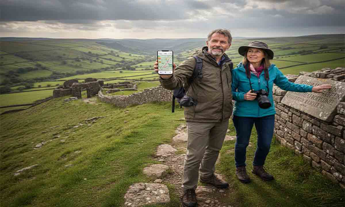
Modern tools help turn that instinct into something concrete. A simple travel time calculator lets you combine driving distance, walking pace, and stops into a realistic plan. Used well, it keeps your day calm rather than rushed. Used early, it shapes smarter choices before you leave home.
Trip Summary at a Glance
- Match Roman sites to real travel time
- Balance walking pace with terrain
- Plan fewer stops, enjoy them more
- Leave buffer time for weather and crowds
Why Roman Sites Demand Careful Timing
Roman remains are not theme park attractions. They sit in fields, on ridges, or at the edges of towns. Paths are uneven. Distances look shorter on maps than they feel underfoot. A mile across grass and stone feels different from a mile on pavement. Planning purely by mileage misses that reality.
In Cumbria, this becomes obvious fast. A morning at Birdoswald followed by an afternoon drive toward the coast seems easy on paper. The land in between changes that calculation. Hills slow walking. Narrow roads slow cars. Parking adds its own delay. These factors shape how much time you truly have at each stop.
Roman planners understood this well. Their roads were measured in time as much as distance. Soldiers marched at set paces. Messages moved on known schedules. Thinking the same way brings modern visitors closer to how these landscapes once worked.
Turning Distance Into Real Time
Distance answers where. Time answers whether. A trip that looks tidy on a map can become stressful once walking time and transitions are added. This is where calculation changes planning habits. Instead of stacking locations, you begin ranking them.
Start by listing each site you want to see. Then consider how you move between them. Driving covers ground fast but adds parking and orientation time. Walking deepens experience but costs energy. Blending both requires honesty about pace.
For example, linking inland forts with coastal remains often sounds appealing. Once timed properly, many visitors choose one inland cluster instead. That choice often leads to a calmer and richer day.
Walking Pace and Roman Landscapes
Walking speed is personal, but terrain shapes it. Roman sites often sit where views matter. That means slopes. Stone paths. Grass worn slick by rain. A relaxed pace keeps attention on the site rather than footing.
Most visitors overestimate how fast they will walk between remains. A measured pace allows for pauses. You stop to read signage. You step aside for photos. You look outward from ramparts. All of that adds time, and it should.
This is especially true at Hadrian’s Wall. Sections feel compact until you start walking them. Even short stretches reward patience. Rushing undermines why people come in the first place.
Structuring the Day With Intent
A Roman-history day works best with a clear spine. Choose one anchor site and build around it. Everything else becomes optional rather than mandatory. That mindset reduces pressure.
For visitors heading inland, understanding the strategic role of upland forts adds context to timing decisions. Reading about Hardknott Roman Fort before planning reveals why reaching it takes effort. The journey itself mirrors its original isolation.
Once the anchor is set, add one supporting site. Leave the rest as stretch goals. This keeps the day flexible. If the weather turns or energy drops, you still leave satisfied.
Numbered Planning Steps That Actually Help
A structured approach keeps planning simple. Each step builds on the last without overloading detail.
1. Choose one primary Roman site for the day.
2. Measure realistic travel time to that site including parking.
3. Add walking time within the site at a relaxed pace.
4. Select one nearby secondary stop only if time allows.
5. Reserve at least one unplanned hour for rest or weather.
Using Museums to Balance Outdoor Sites
Outdoor ruins pair well with indoor collections. Museums reset the body while continuing the story. They also anchor timing. Opening hours create natural boundaries in the day.
Tullie House plays this role well. Artifacts ground what you see outdoors in daily life. Planning a visit becomes easier when you know what to expect inside. The perspective offered by Tullie House collections often shapes which ruins feel most meaningful afterward.
By placing museums mid day or late afternoon, you balance exertion with reflection. This rhythm mirrors how Roman soldiers alternated labor with administration.
Informational Planning Table
| Site Type | Average Walking Time | Terrain | Best Time of Day |
|---|---|---|---|
| Hill Fort | 60 to 90 minutes | Steep grass and stone | Late morning |
| Wall Section | 45 to 120 minutes | Mixed paths | Early afternoon |
| Museum | 60 minutes | Indoor floors | Midday or late |
Allowing Time for Context, Not Just Movement
Roman history is layered. Reading inscriptions. Spotting reused stones. Imagining missing structures. All of this takes time that maps ignore. Planning should account for thought as much as steps.
This becomes clearer when walking along former Roman roads. Their routes explain why forts sit where they do. Understanding that connection deepens visits and justifies slower pacing.
Modern heritage guidance often echoes this approach. The Hadrian’s Wall overview highlights how geography, logistics, and time shaped Roman control. Reading it alongside a well planned itinerary brings the landscape into focus.
Closing the Day With Perspective
A Roman-history day trip should feel complete, not exhaustive. You should leave with questions, not sore legs and frustration. Thoughtful timing makes that possible. Measuring distance alone misses the lived experience of these places.
By translating distance into time, and time into choice, you honor both the sites and your own limits. That approach mirrors Roman planning more closely than rushing ever could. The landscape rewards those who move through it with patience.
The best days end with enough energy left to reflect. You notice patterns. Roads align. Forts relate. History settles into place because the clock never felt like an enemy.